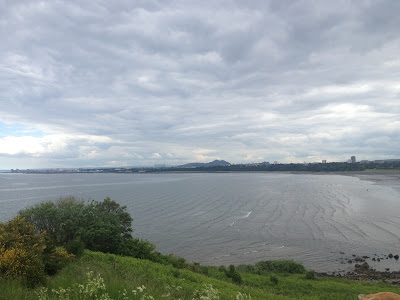
Cramond Island is situated in the Firth of Forth, due north
of the village of Cramond, on the mainland. It is about 1/3rd of a
mile across and about 19 acres in area.
 Like St.Mary’s island, it is accessible on foot at low tide,
for a period of 2 hours either side of low water. I had first spied the mile long causeway to
the island back in November 2012 when I had run the Edinburgh parkrun which
starts on Silverknowes promenade, the western end of which is where the
causeway starts. However on that crisp clear Saturday morning it was high tide,
and it was the long row of equidistant triangles jutting above the waves that
caught my attention, like the teeth of a crocodile ready to bite.
 There must be quite a tidal range, for it was the mere tip of the iceberg I could see that day before me, at low tide the concrete teeth loom above you as you walk across the causeway, standing over 3m tall, ravaged by the Forth but still standing as a reminder of their original purpose to prevent enemy submarine entry during World War II.
The causeway itself starts out just a little lower than the promenade
and in fairly reasonable, paved, condition. However after about 150m you are
required to drop onto a rough battered stone foundation just above the sand
level with little assistance other than a few roughly hewn steps into the end
of the higher level, or the adjacent pillar.
The majority of the causeway can just about permit three
abreast, and hasn’t been maintained well. Despite this, and being a sunny day,
this is a popular walk, though footwear choice didn’t seem top of most peoples
agenda, sandals and heels being some of the poorer choices.
The condition of the causeway and the mass visitors were a
good indicator for the island as a whole – not much to write home about.
Basically an unkempt patch of land with a few wartime ruins dotted about that
potentially had interest but in reality were quickly passed by. Once on the
island I walked up a sandy path to the top of a small hill, and took in the
island’s best feature, the vast views afforded in all directions, over to Fife,
up to the Forth bridges, and towards Edinburgh, with Arthur’s seat, and some of
the Seven Hills I had earlier run up visible as a backdrop.
In comparison to those hills, this island was sadly a
nothing, somewhere for Edinburgh folk to come and loiter it seems, by the
endless glass shards from alcohol, burnt out patches of land marking barbeque
bases, and graffiti on the crumbling brick and concrete relics. The remaining
land was untidy, scrubland and overgrown for the most part, but while what
could be read of the vandalised noticeboards promised some wildlife, at low tide
it probably beats a hasty retreat until the island becomes empty once more.
In the middle of the island it was so overgrown you could
not tell you were surrounded by sea/sand, and the whole place could have been
anywhere left to nature’s own devices, land locked or sea bound. On one hand,
this is no bad thing, the hand of humanity is slowly being washed away, apart
from summer days when four hours of action take place. But it does suggest that
an important part is played by man in shaping the atmosphere on an island, be
that in what he builds, or in this case what he does – this was an island where
quiet was needed, but today was the wrong day for that.
As I headed back to the mainland with less than an hour to
spare people still walked outwards, perhaps the island is too tempting a target
to ignore for those out for a Sunday stroll, but a quick google leads to many
stories of lifeboat rescues for those trapped by the tide. Conversely, I could
be wrong, but no effort seems to be going into the maintenance of the causeway so
soon boat may be the way to go? The
sands do remain to walk on, but they are crossed by a few channels of water,
one thing is for sure, the giant teeth will point the way for many years to
come…
Mode of Transport – Foot
Distance Travelled on Island– 1000m
High Point – 28m
Population – 0
Area – 19 acres
Largest Town – n/a
Highest Point – 28m
LINKS


